Doña Ana County lifts most Hatch Valley flood evacuations
Rincon remained under an evacuation notice late Tuesday over standing floodwaters after McLeod Dam suffered a small piping failure.
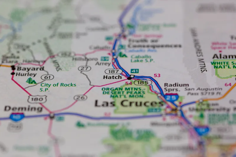
Doña Ana County, New Mexico, lifted evacuation orders late on Sept. 29 for Hatch, Salem, Garfield and Placitas, hours after officials warned that McLeod Dam was close to failing and urged residents of five farming communities in the Hatch Valley to leave. Rincon remained under an evacuation notice, the county said, "due to the dangers of standing floodwaters."
The emergency began around 2 p.m. Tuesday, when an alert went out warning of a "life threatening situation" because of the "imminent failure" of the dam at Garfield, according to KRWG. The National Weather Service office in El Paso issued a flash flood emergency in effect until 4:45 p.m.
At 8:30 p.m., county spokesperson Ariana Parra said the dam had suffered "a very small piping failure" that had since been mitigated, the Albuquerque Journal reported. "No water is exiting from the dam at this point," she said, adding that pumps were on their way to the structure to move water downstream and relieve pressure. Structures in the area remained at risk of overtopping if more rain fell, Parra said.
How the dam emergency unfolded
County notices first went to Salem and Garfield, the small agricultural communities north of Las Cruces where the McLeod Dam, known locally as the Garfield dam, showed signs of potential failure. Rincon was added as conditions worsened. Shortly before 7 p.m., the county extended the orders to the village of Hatch, and Placitas, to Hatch's west, followed within an hour.
Evacuees were told to drive south on Interstate 25. The county used a three-tier "Ready, Set, Go" system: prepare and gather essentials at Ready, be prepared to leave immediately at Set, and leave at once by the recommended route at Go. Rincon, Garfield and Salem were placed in the Go phase while Hatch was still at Ready, KVIA reported. The county urged residents not to wait until conditions worsened before preparing.
New Mexico State Police helped evacuate Garfield Elementary School earlier Tuesday, said Sgt. Ricardo Breceda, a spokesperson for the agency. Breceda said officers, federal resources and swift rescue teams were in the area and that as of 5:15 p.m. there were no reported fatalities or injuries.
Garfield has approximately 100 residents, based on the 2020 Census and more recent survey data, the Albuquerque Journal reported. Rincon has fewer than 300 and Salem reports fewer than 1,000. Hatch, the largest of the communities, has a population between 1,500 and 1,600, and Placitas has a few hundred residents. It was not immediately clear how many people were served at the shelters.
The dam and its inspection record
McLeod Dam is a 25-foot-high earthen dam built to reduce flood risk, and it can hold back about 750 acre-feet of water, according to the National Inventory of Dams. It sits northwest of Hatch, in northwestern Doña Ana County, upstream of the farming communities that were told to leave.
The dam's last inspection on record, in 2023, found it in poor condition and carrying a high potential hazard classification, with no emergency action plan in place, KRWG reported, citing the National Inventory of Dams.
Interim County Manager Stephen Lopez said Tuesday afternoon that a potential dam failure warning was out for the area, according to the Albuquerque Journal. Operators of the dam reported the imminent failure, with the possibility of catastrophic damage and life threatening situations in the path of the water, KVIA reported, citing the emergency notice. "SEEK HIGHER GROUND NOW!" the weather service's El Paso office said in its emergency bulletin.
Shortly before 7 p.m., the Rio Grande gauge near Rincon measured 10.8 feet, with a flow of 6,250 cubic feet per second, the weather service's El Paso station reported. County Commission Chairman Manny Sanchez, whose district includes the Hatch Valley, told the Albuquerque Journal he visited the area Tuesday afternoon and found the river "at its banks" near Rincon, which he said was "hit pretty hard." A stream breached levees near a water treatment plant in Rincon, threatening nearby buildings, Newsweek reported, citing officials.
Roads closed and shelters opened
Flooding closed several roads, the county said. NM 185 was shut in both directions from mile marker 32 at Angostura to mile marker 18, three miles north of Radium Springs. NM 140 was closed from mile marker 1, one mile south of Rincon, to mile marker 2 at Rincon. NM 187 was closed from mile marker 6, one mile north of Salem, to mile marker 8, one mile south of Garfield.
Evacuees were directed to the Radium Springs Community Resource Center at 12060 L B Lindbeck Road in Las Cruces and the Doña Ana Community Resource Center at 5745 Ledesma Drive in Las Cruces. Residents unable to travel south of Hatch were told to go to Hatch Valley High School at 170 Herrera Road.
| Community | Approximate population | Status late Tuesday |
|---|---|---|
| Hatch | Between 1,500 and 1,600 | Evacuation order lifted |
| Salem | Fewer than 1,000 | Evacuation order lifted |
| Garfield | About 100 | Evacuation order lifted |
| Placitas | A few hundred | Evacuation order lifted |
| Rincon | Fewer than 300 | Still under evacuation notice |
The American Red Cross sent representatives to set up temporary facilities. Carina Gonzalez, the organization's community disaster program manager for southern New Mexico, told KRWG the Radium Springs site would be a safe and warm place to stay overnight, with cots, snacks and water, and that the Red Cross would remain as long as it was needed. Around five to seven residents were there when she spoke Tuesday evening.
U.S. Border Patrol was among the agencies assisting at evacuation sites and shelters, the county reported on its social media channels, adding that agents were not conducting immigration enforcement at this time. Schools in the Hatch Valley announced they would close Wednesday.
Residents were told to bring medications, identification, important documents, necessary supplies and items for children and pets, to keep vehicles fueled and to monitor official county channels for changes in evacuation status. Drivers were warned never to attempt a flooded or barricaded roadway because conditions can change quickly. A flood warning for the area remained in effect until 5:15 a.m. Wednesday.
Polo's remnants fuel a wider flood threat
Remnants of Hurricane Polo drove the rainfall. Polo made landfall Monday night in Mexico's Baja California Sur and weakened from a hurricane on Tuesday, with its remnants moving north toward the United States carrying large amounts of tropical moisture, Newsweek reported. The weather service issued three separate flash flood emergencies in New Mexico on Tuesday evening, according to Fox Weather, the most recent covering the entire Hatch Valley in northwestern Doña Ana County through 8:45 p.m. MDT.
A flood watch covered 10 states on Tuesday, with the highest flood risk through Wednesday in parts of Arizona, New Mexico, Colorado, Kansas, Oklahoma and Texas. Fox Weather put more than 150 million people at risk over the week as storms stretched from Texas to Minnesota. Nearly 80 trillion gallons of water could fall across the United States during the week, according to forecasts cited by Newsweek, an amount equal to about 121 million Olympic-sized swimming pools.
If there's a really heightened sense of potential for property loss and impact to life, we'll issue a flash flood emergency, which is basically the highest level.
Shoemaker, speaking to The Santa Fe New Mexican, said that was the level the weather service had issued and described it as a particularly dangerous situation. Forecasters said several dams in the region were near full because of intense runoff, and that saturated ground combined with more heavy rain could produce dangerous flash flooding, especially in areas scarred by wildfires.
In southern Colorado, forecasters warned of flash flooding in wildfire burn scars, including the Aspen Acres Fire area. The Weather Prediction Center forecast three consecutive days of moderate risk for excessive rainfall from Tuesday through Thursday, Level 3 on its four-level scale.
Moisture from Tropical Storm Rachel was expected to add to the system later in the week, with heavy rain possible from Texas to Minnesota. Parts of New Mexico, Colorado, Oklahoma and Texas remain in drought, and forecasters cautioned that rain falling too quickly produces dangerous flooding rather than relief.
Farmers watched the water through the night
Alessandra Alanis watched Tuesday as water poured through, out and over the dam near where her family farms pecan trees and other crops. "We have farmland and employee housing surrounding this dam," she told The Santa Fe New Mexican, describing the area as covered in debris from the mountains and the water that rushed through. Alanis picked up her daughter from Garfield Elementary School around 1 p.m., shortly before the evacuation orders came in, and said the dam was still standing at 6 p.m.
State Rep. Nathan Small was at the evacuation point at the Radium Springs Community Resource Center. He said reports described water coming over the top of some flood control facilities in the northern part of Doña Ana County and flooding in the village of Hatch, and that people in specific areas were being asked to leave, KRWG reported. Everyone needed to be on a higher state of awareness and caution, he said.
The county told residents to monitor its official social media pages and website for updates and any change to evacuation status. Those returning home were urged to use caution because flooding, debris, damaged roads and other hazards could remain, KVIA reported.
Sources
- The Santa Fe New Mexican: Evacuation ordered in Doña Ana County due to flooding, dam failure threat
- KRWG: Evacuation orders for Hatch, Garfield, Salem, Rincon, Placitas issued over dam failure and flooding concerns
- KVIA: Doña Ana County encourages Placitas residents to evacuate
- Albuquerque Journal: Doña Ana County evacuates Hatch Valley communities over McLeod Dam failure risk
- Newsweek: New Mexico Flash Flood Emergency as McLeod Dam Faces Imminent Failure
- Fox Weather: New Mexico dam nears failure as 25+ states face dangerous flood threat